Services
Contact Info
- 935 Brewster Ave Ste B - Redwood City, CA 94063
- (650) 995-7150
- info@altosrepro.com
Format Instructional Download
Satisfied and Precise work
Let our experts do it for you.
Quality& Industry Trusted Tools
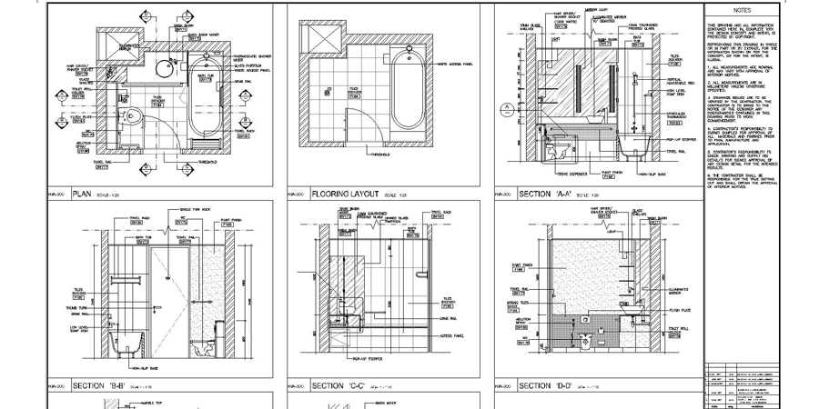
Our Powerful vectorization tools help us edit and enhance your scanned drawings. Make the most of raster images, maps, aerial photos, satellite imagery, and digital elevation models.By adding Geofences, estate lines, or other precise infrastructure to satellite photos, Autocad tools can bring deep insight into any project.
Skilled Technicians
Illustrator, like autodesk, has great potential to develop precision CDC outlines, & help facilitate the transfer from idea to concept.
Work Details and other info
- Price: $75/ File
- Location: 150km around
- Time: =/1 72 Hrs
- Notes: For next working day delivery add $30 per file must be received before noon Pacific Standard Time.
 ● Add & go to Cart
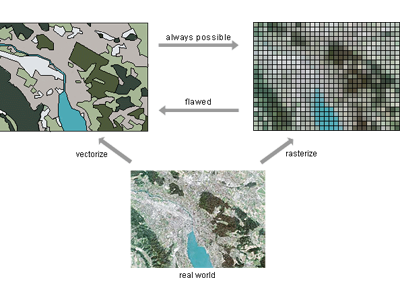
A Diagram Break down of the benefits- both visual and strategic - to cad vectorization